How To Find Your Flood Zone
Understanding your property’s flood risk is essential for design, construction, insurance, and safety planning. Fortunately, identifying your flood zone is straightforward.
Step 1: Use FEMA’s Flood Map Service
Visit the FEMA Flood Map Service Portal.
By entering your address or GPS coordinates, you can quickly access the official FEMA flood map for your property.
Step 2: Review the Flood Risk Maps
The system provides detailed maps organized by city, jurisdiction, and region.
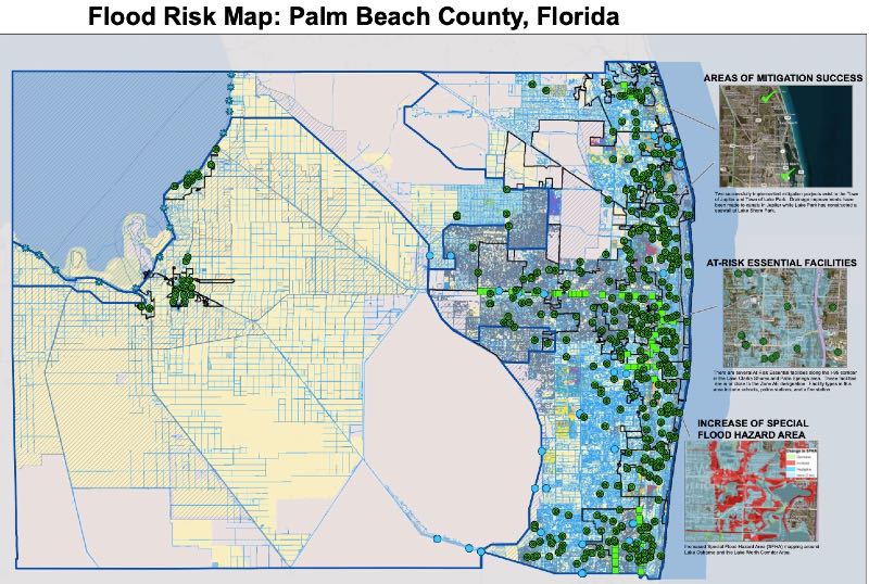
These maps give you a clear overview of the flood risks in your area.
Access them here: Flood Risk Maps
Step 3: Pinpoint Your Exact Location
Zoom in on your specific address to see your property’s flood zone designation.
This step provides the critical information required for permitting, insurance, and compliance purposes.
To illustrate, here’s a FEMA Flood Map for our corporate headquarters area, showing exactly the kind of detailed output you can expect from the site.
For guidance with your next project, explore our Plans, Calculators, Knowledge Base,
or contact us directly for site-specific support
Last Update: September 30, 2025
Related Knowledge Base Posts -
- FAQ: What do I do if a TER or Generic Performance Evaluation isn’t approved for a permit?
- Wind Speed vs. Wind Pressure Explained
- FREQUENTLY ASKED QUESTIONS ABOUT EXPRESSPASS
- Glossary of Engineering Terms
- Can you help me find Existing Florida Product approval, Miami Dade NOA, or ICC-ES information and plans?
- FAQ I need a wind calculation for a roof. Can Engineering Express help with that?